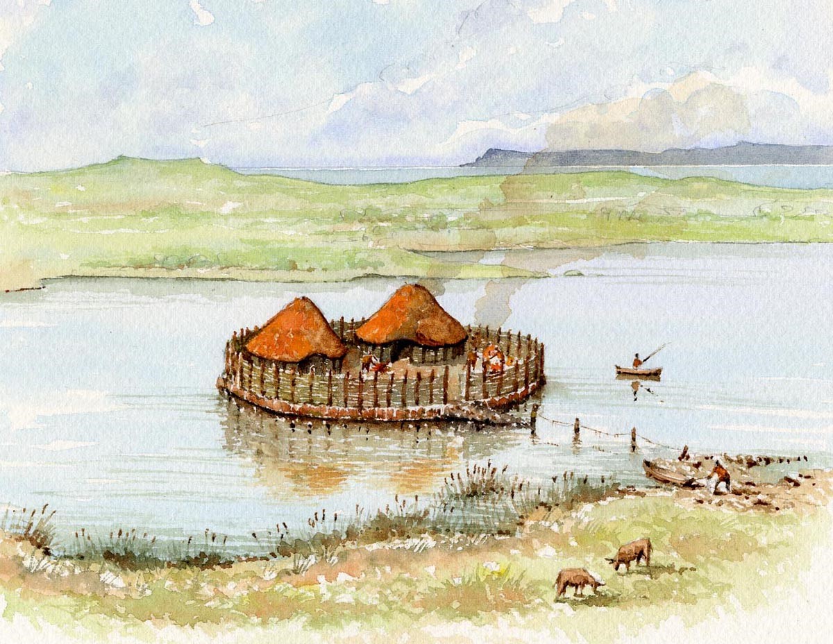
Archaeology – Lough Gara’s Crannógs
Lough Gara is only 8km east of Ballaghaderreen town and lies. It is famed for having a high number of crannógs or ancient habitations on its shores and is perhaps one of Ireland’s best kept secrets. They were discovered in 1952 when drainage work was carried out on the lake. The word crannóg comes from the Irish words, crann, meaning tree, and óg, meaning young or, more accurately, small woods. There are various estimates of the actual number of crannógs on Lough Gara, with numbers ranging from 145-369. Crannógs are man-made islands mainly used as a defensive refuge or stronghold. It is thought they were occupied by various social classes with them being used as royal residences, ecclesiastical settlements and also serving as craft centres. In Ireland, crannógs were used in the Late Bronze Age, all the way through to the Middle Ages. The crannógs at Lough Gara date from the Late Bronze Age to the Early Iron Age making them over 2000 years old. The lake and nearby rivers are rich in votive offerings with many artefacts recovered. Several of the crannógs have been excavated. At one of the sites bracelets made of solid tin dating to the Bronze Age were found, this was a very valuable alloy at that time. The remains of 31 dug-out canoes which were used to access the crannógs were found at the bottom of the lake. When these wooden boats were discarded, they found their way into the material used to build many of Lough Garas crannógs. Evidence of Iron Age activity comes in the discovery of a bog body buried beside the lake in Derrymaquirk townland, the body was that of a woman aged 25 years. The body was radiocarbon dated to the Iron Age between 750-200BC. Further evidence of Iron Age activity is from a La Tene sword that was found in the thatch of a cottage in the townland of Cashel, north of the lake. This land has a connection with the Mcloughlins who owned Inch Island on L.Gara, the sword possibly derived from there.
Below is an article on the excavation that took place on the crannogs at Lough Gara.
Archaeological Investigations in Lough Gara Echoes of Ballaghaderreen, 1997 By: Christina Fredengren, Dept. of Archaeology, Stockholm University, Sweden
What did it mean to live and work on the boundary between land and water; why did it make sense? These are questions that the Crannog Research Programme in Monasteraden set out to answer with the excavation of a small artificial island on the western shores of Lough Gara.
The summer of 1997 was an extraordinary wet and rainy summer, the lake level in Lough Gara was high and inundation was not uncommon even in the villages around the lake. The summer was also the time when the Crannog Research Programme started the excavations of a small artificial island- a crannog – in Lough Gara. The excavation followed two earlier seasons of work, the first in which the shores of the lake were surveyed for yet unrecorded crannogs, while also checking the preservation status of already known ones. The second season was spent doing minute mapping of a few model areas. Among these was the area in Shroove which got all the attention this summer.
This place was chosen as it contained a representative number and types of monuments. On the shoreline in Shroove there are two small artificial islands, which now are situated on the water meadow and a larger crannog, still in the water. The two small ones have quite broad causeways leading into an old shore line. Most of the artificial islands in Lough Gara are of a smaller type, although both of the crannogs that were excavated in the 1950’s were of the larger type. To get an understanding for the lake settlements as a whole one of the small crannogs were chosen for an excavation. This excavation will answer questions about what it meant to work and live on the shores of Lough Gara, on the boundary between land and water. Why did it make sense to construct islands on a lake that holds many natural islands?
The site that we chose to excavate is the southern of the two small ones. What we found was that it is a place that has been used and rebuilt about four times. This means that they went back and remodelled the earlier crannog building to make it into another shape at least four different times and building techniques are as important as finds for the archaeologist.
The Excavation:
This is a short recapitulation of what we found at the various phases. When it was cleared of bushes and briars it looked like a flat circular platform, consisting of white sandstone and limestone boulders put together in a very rickety manner. On top of these boulders we found we found a mortar stone, used for grinding some material.
This means that the unstable surface must have been in use at some stage and for that to have happened it must definitely have had a better floor than this. Perhaps it was a floor of flagstones or of planks. When this layer was removed we reached a floor. This floor consisted of smaller shattered and fire-cracked stones, mixed with animal bones. Often the bones found on crannogs are interpreted as the refuse from meals on the island, but here in Shroove it seems as if the bones were a part of the building material. Probably this could have had both a ritual and a practical significance. We are still waiting for the results from the bone analysis and therefore we cannot yet get an understanding of what it meant to live and work on bones.
Under the floor was a layer quite similar to the first layer of boulders. These boulders seem to have worked to raise the height of the island a bit, before putting the above mentioned floor in place. And then came another floor, which again was a mix of shattered stones and animal bones. Under this we found another floor, which looked different than all the floors above; it had the remains of a small fence surrounding its edge. The question here is was it a fence to keep visitors out or to prevent people from falling into the water.
Among the finds this summer were numerous pieces of iron slag. This is a refuse product from iron handling. Finds like this suggest that the site was associated with iron handling, and perhaps it was the workshops of a smith. But why did the workshop have to be placed in the shallow shores of Lough Gara, which in this bay at Shroove was covered with fine sand, sand which would make the site accessible not only by the broad causeway leading up to the site itself? We will return to this question and other questions when the excavation continues in the summer of 1998.
Visit us then:
The Crannog Research Programme consisted of youths from the communities around Lough Gara, working together with a team of experienced archaeologists. This excavation was made possible due to help from the FAS scheme in Monasteraden and with financial support from the peace and reconciliation fund, the Wallenberg Foundation and the student summer scheme. Those students who have an interest in the archaeological activities can contact Clogher Hall in Monasteraden for information about the summer 1998.